Jefferson National Expansion Memorial (Gateway Arch) – St. Louis, Missouri

Gateway Arch

Sandwiched between downtown St. Louis to the west, and the Mississippi River to the east lies the Jefferson National Expansion Memorial.  The 91 acres of the Memorial are home to the Gateway Arch, the Museum of Westward Expansion, and the Old [St. Louis County] Courthouse.  The links provided above provide plenty of details about the Memorial, but briefly, the park was created to commemorate:

  • The Louisana Purchase, and the subsequent westward exploration and expansion of the United States.
  • The first civil government west of the Mississippi River.
  • The debate over slavery raised by the Dred Scott case.

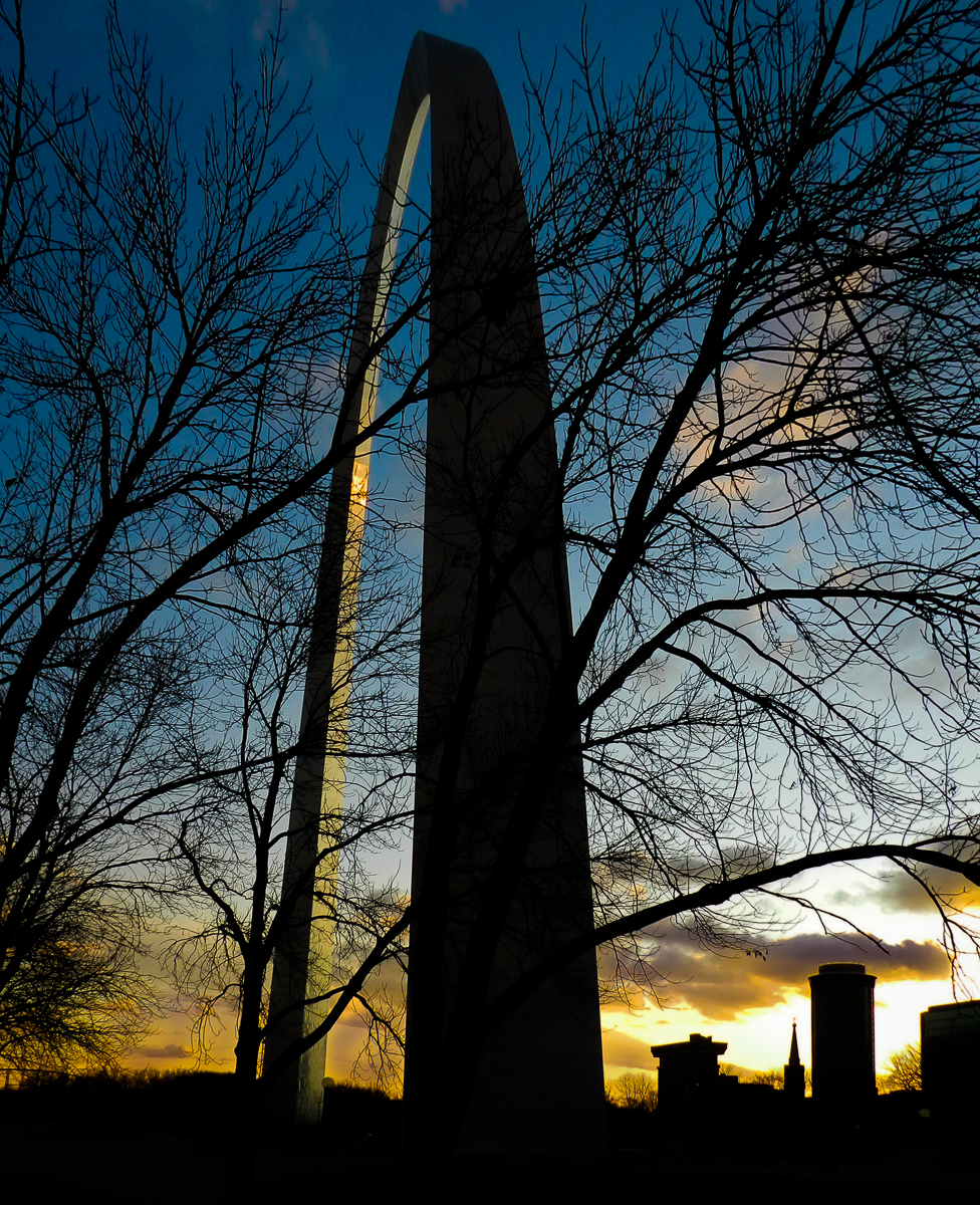
Approaching the Arch on foot from the north, one immediately notices the similarity to the Washington Monument, althought the illusion soon disappears as you move to the side of the towering arch.

The actual size of the arch cannot be fully appreciated until you approach the very base and gaze in an upward direction.  You soon find yourself jockeying for a suitable position to view the entire arch at one time.

Alas, the dimensions of the arch are so vast, and the field of vision of our eyes so comparatively narrow, we come to realize that from this close proximity we can only view a portion of the arch with each gaze.

The height of the arch measures 630 feet, which exactly matches the 630 foot width of the arch at its base.  It is quite an experience to stand directly underneath the apex of the arch and look up – the top of the arch seems far, far away!  It occurs to me that this might be the only time in my life that I have stood directly underneath any structure this tall!  So help me out – if you can think of any example of a structure that a person can stand under that exceeds the height of the Gateway Arch, please leave a comment explaining where.

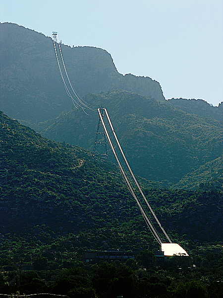
After standing underneath the arch, you might decide to ride the tram to the top of the Gateway Arch.  After purchasing your tickets for the tram, you will make your way to the tram loading station, where you will enter a tram pod for the ride up the inside of the arch.  There are eight tram pods on the north leg of the arch, and eight pods on the south leg.  Each of the pods can hold up to five people.  As you can see from the photo above, the loading zone for the tram is fairly level on the horizontal plane. Yet the tram must travel up an arch leg that is almost straight up on the vertical plane.  How is this accomplished?

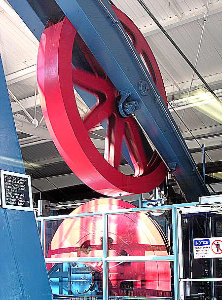
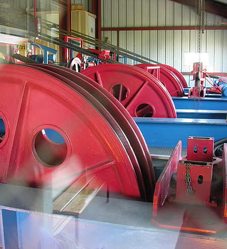
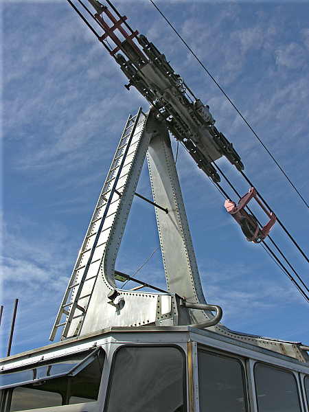
The tram, consisting of eight pods, is not a single structure, but rather a row of eight independently suspended units, as seen above.  The pods are in lateral alignment along the horizontal parts of the journey, and stack up, one above the other on the vertical portion of the ascent.

This is what the interior of the tram pod looks like.  In the off-season, you may end up with a pod to yourself, but each pod holds up to five passengers, albeit snugly.  The trip to the top of the Gateway Arch takes four minutes – the trip down, three minutes.

Once at the top of the arch, the tram lets you off at the observation area, where rows of windows allow you to see the surrounding countryside for many miles in each direction.

Upon gazing out of the observation windows, one is immediately struck with the realization of how high the arch towers above the St. Louis skyline.  To get a sense of size, the enclosed football stadium on the right-hand side of the photo above is the Edward Jones Dome, the home of the NFL’s St.Louis Rams.

Directly to the west is the Old Courthouse, which is also part of the Jefferson National Expansion Memorial.  Most notably, this was the court of original jurisdiction in the historic Dred Scott v. Sandford case, in which the U.S. Supreme Court held that Africans brought to the United States as slaves (or their descendants) were not protected by the United States Constitution, and could never be citizens.

To the southwest one can see Busch Stadium III, completed in 2006 and home of MLB’s St. Louis Cardinals.

To the east one can see the mighty Mississippi River.  The color of the Mississippi River is not as blue as this photo would suggest.  This is simply a reflection of the blue sky above; from a land-based perspective, the river is typically brown.

Looking directly below the arch to the northwest, lies the first of two large reflecting pools.

The second reflecting pool lies immediately below the arch to the southwest.

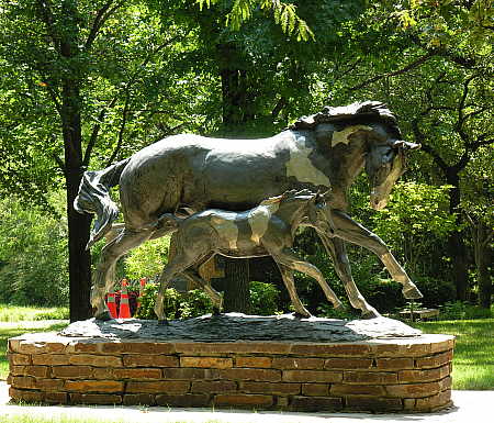
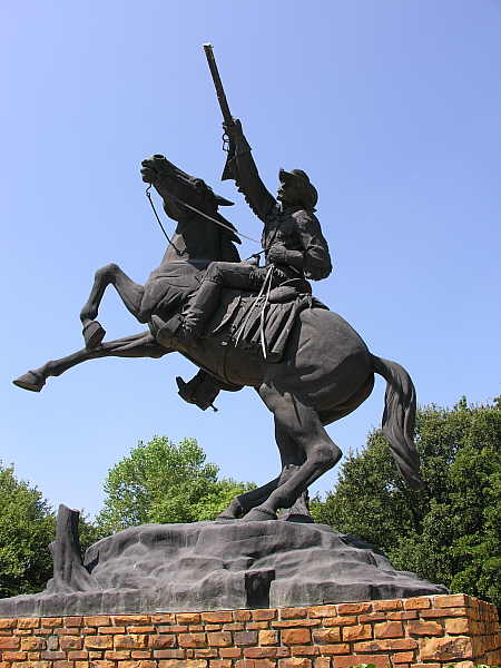
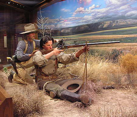
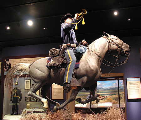
Housed below the arch in an underground facility is the Museum of Westward Expansion, documenting the growth of the United States, from inception to the present, with an impressive collection of artifacts and exhibits.

There are two theaters located within the monument.  One theater shows a documentary film in which you learn how the Gateway Arch was constructed.  The second theater shows an IMAX large screen format film chronicling the expedition by Lewis and Clark to document the western territories of the United States.  Both films are very well done, and worth the time to see.

All-in-all, the time spend exploring the Jefferson National Expansion Memorial is time well-spent. If I didn’t think this was worth visiting, I wouldn’t have posted about it!

Petrified Forest National Park

I have a goal of visiting every major attraction along (or close to) the famous Route 66 within my lifetime.  Why this is, I couldn’t tell you.  Never-the-less, I plug away at it.  So here is yet another Route 66 attraction that is well worth taking the time to see if you happen to be traveling along Interstate 40 in northern Arizona.  I’m referring to the Petrified Forest National Park located within the beautiful Painted Desert of Arizona.

This map shows the outline of the park, along with the major features contained therein.  You may notice that visiting the park, and driving along the main park road will not add a major amount of time to your east or west-bound travel along the interstate.  There is a lot to see within the park, however, so you may want to allocate sufficient time for hiking and sightseeing during your visit.  If you are west-bound on the Interstate, the first thing you will encounter as you divert off the main road is the visitors center, where you can obtain information about the park.  The visitors center is exactly what you might expect, so I have not included any photos of it in this post.

After paying the entrance fee at the park entry kiosk, the first thing you encounter along the park road are overlooks from which you have excellent vantage points of the spectacular Painted Desert.

If you happen along this route at the right time of the year, wildflowers abound, adding a colorful touch to the already beautiful scenery.

As you continue driving, you are rewarded with views of the desert in all directions, each view seeming more spectacular than the previous one.

The clean desert air, combined with the elevated vantage point afforded by the turnouts allow you to see the hills and valleys for what seems a hundred miles.

There are hiking trails along the way that will allow you to explore the area much more thoroughly than if you simply stayed in your automobile.

Soon you will arrive at the Painted Desert Inn National Historical Landmark, which is well worth exploring.

Across the road from the Inn are additional service buildings, built in the same Pueblo style as the Painted Desert Inn.

Visitors are welcome to enter the Inn, where you can see the wonderful architecture and decorating that make this such a special place.

It is worth the effort to search for the little details that make this place unique, such as this hand-crafted light fixture in the bar area.

This mural depicts the dance and ceremonial costumes of the Native Americans from the region.  You will find similar artwork throughout the Painted Desert Inn.

Back on the road heading south, you find yourself within an area of badlands.  Take the time to enjoy the scenery, as these types of geological formations occur only in a few areas of the United States

The starkness of the landscape contrasts nicely with the beauty and colors of the barren, rocky hills.  I can only imaging what this entire area must look like in the evening alpenglow.  Even in the flat, monochromatic lighting of the mid-day sun, the colors pop out at you, daring you to take photograph after photograph.

The jagged landscape appears as if someone had picked it up and crumpled it in their hands.  Can you imagine early travelers attempting to traverse this region?

The perceptive tourist will notice the varied and unusual rock formations that seem to occur whichever way one looks.  Combined with the wildflowers, they make excellent photographic subjects.

Besides the isolated rock outcroppings, there are many examples of cacti and desert vegetation managing to eke out an existence in the hot, arid desert climate.

This area of badlands has a nice paved pathway that makes for pretty easy hiking.  It is a great way to stretch your legs from all the driving you might have been doing along Interstate 40, and allows you to see the details that make up this terrain from close-up.

The colors in these badlands seem to change minute-by-minute, particularly when the clouds dance along in the sky above.

The trail through the badland canyons is paved, as you can see here.  This is the only section of the trail the really causes physical exertion, so take it slow and easy here.  The rest of the trail is relatively flat, making it easy to hike.  I witnessed tourists of all ages and conditioning walking along the trail, so don’t be hesitant to give it a try.

One thing you notice as you walk the badlands trail is that the scenery looks entirely different from the bottom looking up, as opposed to looking down on the badlands from above.

As you can see, I wasn’t pulling your leg when I stated that the badlands trail flattens out at the bottom.  The views along this section of trail are great, and you can enjoy a leisurely stroll as you partake of the picturesque scenery before you.

From this vantage point near the top of the trail you can see how the paved path wends its’ way through the canyon.

After returning to your automobile and heading south again along the park road, you will finally arrive at areas that contain the stars of the park, namely the petrified wood (interchangably called petrified rock).

These photographs were taken in a section of the park called the Crystal Forest.

As you amble along the paved trail you will come across hundreds of pieces of petrified wood.  Although it is called petrified wood, it is not wood at all, but actually stone.  It once was wood, as these were formed by the permineralization of toppled trees.  In an amazing process, the wood morphs into stone, leaving the rock in a shape that is exactly the same as the host tree that allowed it to form.

In this piece you can even see how the structure of the bark is apparent in the rock.

The photograph above clearly shows the host tree trunk that turned into stone long ago.  It almost looks as if someone segmented the trunk with a stone-cutting chain saw.

Again, a clear example of a tree-turned-to-stone.

And another.

When the desert flora and cacti grow in proximity to one another, it creates a magnificent sight, as well as a great photo-op.

These pieces of petrified rock reveal the rings that existed within the tree trunk, and which have been preserved in the permineralization process.

This segment evidences both the rings of the former tree, as well as the bark on the outer surface.

The sections of petrified rock above and below show the coloration that the stone takes on as it morphs.  In the gift shops outside the park, one can purchase pieces of petrified wood that have been harvested from private land outside the park.  The pieces that are for sale are usually cut smooth and polished, creating a shiny, colorful piece that makes a beautiful display in ones’ home, and becomes a wonderful momento to remind you of your visit to Petrified Forest National Park.

In closing, I would whole-heartedly recommend a visit to the park, preferably with enough free time to hike along at least one of its’ many trails, and to savor the spectacular scenery that only occurs here.

The Land of Fire and Ice

Not long ago, while traveling in northwestern New Mexico and looking for scenic alternatives to Interstate 40, I picked up an informational pamphlet extolling the virtues of New Mexico’s Scenic Route 53, also known as the Ancient Way – a traditional route between the Pueblos of Zuni and Acoma.  Examining my map, I saw that this route passed many interesting locations, far more than I could take the time to explore on this particular trip.  But I did manage to devote a few hours at one worthwhile destination – the Land of Fire and Ice.

The Fire

El Malpais National Monument is situated along Scenic Route 53.  As a land feature, El Malpais – “the badlands”- is used locally to refer to lava flows.  Within El Malpais National Monument are many volcano craters, onetime sources of the area’s lava flows.  One such crater, Bandera Volcano, lies on the Continental Divide, and hiking to the site is an easy mornings stroll through the clean mountain air.

The trail to Bandera Volcano begins near the parking lot of this old trading post, built in the 1930’s, when the Zuni Mountain Railroad was operational and logging operations were underway in the area.  Today, the trading post sells jewelry, pottery and artwork of the local tribes.

Scattered around the grounds of the old trading post are various outbuildings, visitor facilities, and relics, such as this old wagon seen at the trail head.

Soon, the trail leads up the side of the crater,  passing beneath the limbs of ancient trees, which include Ponderosa and Piñon Pines, Douglas Fir, and Alligator Juniper.

There are many spots along the trail to Bandera Crater where the vista overlooks much of El Malpais, the Cibola National Forest, and the Chain of Craters Backcountry Byway, as exemplified in the photograph above.

Because of the hard, rocky terrain, trees cannot establish a deep root system.  This results in trees that mature to be twisted and gnarled.  Trees such as this can be seen in many places along the trail.

The trail eventually passes a rest stop, where the breeze blows cool, and the scenery is delightful to view as one relaxes for a momentary breather.

Continuing along the path, the trail rounds a bend, and you are suddenly presented with your first glimpse of the Bandera Volcano crater.

Further along, the trail ends at a viewing overlook, where the cinder cone crater can be seen in it’s entirety.

The Ice

From the old trading post, another trails heads off in the opposite direction from the Bandera Volcano.  This one leads to a feature called the Ice Cave. 

The trail to the Ice Cave passes several more examples of the twisted, gnarly root systems exhibited by the local trees, as seen in the photograph above. 

After a short stroll, the trail leads to the entrance to the Ice Cave.  And what is this Ice Cave?  It is part of an old lava tube that was formed in the eruptive stage of the nearby volcanic crater.  As the surface lava cools and crusts over, the lava beneath continues to flow.  This creates a pipeline known as a lava tube.  The Bandera lava tube is considered to be the longest lava tube in North America, at 17.5 miles in length.

The entrance to the Ice Cave begins by descending steeply into the cave via this initial set of covered stairs.

Once you reach the bottom of the initial set of stairs, you still have to negotiate the second flight of stairs.  This second flight is uncovered, as you can see above.

Finally, you can descend to the viewing platform located at the bottom of this third set of stairs, in order to view the ice at the bottom of the cave from a close distance.

This is what the ice at the bottom of the Ice Cave looks like.  It is a sheet of ice 20 feet thick.  The temperature of this cave never rises above 31 degrees Fahrenheit.  Rain water and snow melt seep into the cave, adding to the ice each year.   The deepest (and oldest) ice in the sheet dates back 3400 years.

The Ice Cave can be considered a perfect natural icebox – 20 feet of ice contained in a well insulated cave shaped to trap frigid air.

Hmmm…… I wonder if I could build something like this back at the ranch? 

Devil’s Rope Museum

Ouch!!  A sting from a normal sized scorpion can be very painful – I know this from personal experience.  But can you imagine encountering a foot-long scorpion?  I have come face-to-face with one of these giants, as evidenced by the following photograph.

I ran across this specimen (metallica hadrurus arizonensis) while visiting the Devil’s Rope Museum in McLean, Texas.  And if this one isn’t large enough to frighten you, how about a scorpion the size of a human being?  It must have existed, because I read about it on the Internet – specifically, here.

But back to the Devil’s Rope Museum,  which claims to be the largest barbed wire historic museum in the world, and is the topic of this post.   I visited this museum while passing through McLean, Texas, shortly before writing a  previous post  regarding my pathetic little collection of barbed wire and fencing tools. 

McLean, Texas (pop. 830) lies along the path of old Route 66, which I happened to be exploring this past Fall.  After a delightful lunch stop at the Red River Steakhouse  (a place with real cowboys and cowgirls seated at the tables, excellent rib eye steaks, and great fresh cobblers included with all meals), the Devil’s Rope Museum caught my eye as I was departing town.  Grabbing my camera, I headed inside to see what might be on display.

The museum offers a variety of exhibits related to barbed wire and fencing, as well as barbed wire art, such as the scorpion (as seen in the first photograph), and the woven wire hat, seen here.

This photograph shows one example of the portable wire fence fabrication machines the museum has on display.

In times past, many rural ranchers utilized the top wire of their barbed wire fencing to transmit electrical communications signals (telegraph, telephone, etc.) from point to point.  These ranchers soon became well-versed in the concept of electrical insulators, and began using any appropriate items or materials that might have been on hand at the moment, as seen in the preceding photo.

In those parts of the plains states where timber was in short supply, substitute materials would be found for the construction of fence posts.  The photo above shows a clever seat/hand drill device used to bore holes in stone fence posts – a daunting task, indeed!

This is an uncommon earth auger designed to be powered by a vehicle’s 12 volt electrical charging system.  Perhaps these tools will make a comeback as a result of $4.00/gallon gasoline.

This is just a small sample of the thousands of styles of barbed wire that the Devil’s Rope Museum has on display throughout the building.

Here are some of the various designs and sizes of fencing staples that are on display, along with an explanation of what the different types of staples are used for.

The museum hosts a nice size collection of branding irons and brands, including this example of early land grant brands.

Because the Devil’s Rope Museum is located along old Route 66, the facility includes a small, but nice exhibit pertaining to the Texas portion of Route 66.

On display within this section of the museum is this mock-up of a 1940’s era diner, with all of the appropriate appliances and accouterments.

You may remember reading my previous post about the Big Texan Steak Ranch in Amarillo, Texas.  If so, you may be interested to know that the cast model steer on display at the museum (seen above) is the steer that graced the original location of the Big Texan.  If you look back at that previous post, you will see that the current steer replica is vastly larger than this original one.

In addition to this small sampling of the exhibits at the Devil’s Rope Museum that I have depicted above, I also viewed a special photographic collection pertaining to the Dust Bowl era that afflicted the mid-west region in the 1930’s.  Seeing the disaster that took place, and the human devastation that resulted was a heart breaking experience.  Because I did not take photographs of the exhibit (for copyright reasons),  I have included  this link  to a website containing similar photographs.  It is well worth a click over to the site.

Elk City, Oklahoma – Old Town Museum Complex

Last month I took a road trip from Arkansas to California and back, which is a trip I have taken many times in the past.  In order to add a little more interest this time around, I decided to travel over as much of the original Route 66 as was reasonably possible, given the overall time I had alloted for this particular trip. Along the way, I sampled some of delightful places that this route took me near.

Since my camera is once again off traveling without me, I thought I would share some of the sights that I saw along Route 66 over the next few days.  In case you haven’t noticed, I have already posted about several of these sights already.  There was the post about the Nation Cowboy and Western Heritage Museum in Oklahoma City, Oklahoma.  And then the post about the Sandia Peak Tramway in Albuquerque, New Mexico, and of course the Burma Shave signs  I ran across while driving on Route 66 in western Arizona.

Today’s post is about the Elk City Old Town Museum Complex, located along Route 66 in western Oklahoma.  The museum complex was quite impressive, particularly considering the small size of Elk City (population – approximately 11,000).

The complex is comprised of a replica old western town, with all the types of buildings you would expect to see in such a town, along with several museums, some of which I’ll show you in a moment.  Above is the Opera House replica (which can be rented for weddings and other occasions).

Here is a bank and mercantile building that is located along one side of the park, which is home to the museum complex.

Inside the buildings are authentic antiques from days of yore, such as the surgical facility shown in the photograph above.

There is a replica train depot which you can visit, along with an authentic railroad caboose that you can walk through.

This is an actual old school house that was originally located in a nearby town.  It was dismantled and rebuilt at this sight, and contains the  furnishings and accoutrements you might expect to see in an old school house on the prairie.

One of the museums contained in the complex is the National Route 66 Museum.  Visiting the Route 66 museum is the reason I sought out the Elk City Museum Complex in the first place.

Within this museum are displays of the scenes you would be likely to see while traveling along Route 66, such as the Navajo peddler depicted above, or the old-time service station recreated in the photograph below.

This sailor, hitching a ride along Route 66 in the southeast corner of Kansas, is a very long way from any ocean.  I wonder if his destination is the Atlantic, or Pacific ocean?

Considering that the National Route 66 Museum was the reason for my visit, I felt a little let down with it’s contents and displays.  I found nothing on display that was particularly unique or compelling, and if it were the only draw to the Elk City Museum Complex, I would have been disappointed.

The portion of the complex that I found most appealing was the Farm and Ranch Museum, which is comprised of an outdoor display area, along with a large indoor facility (seen in the background in the photograph above).

The museum owns a collection of windmills, each one with some special pedigree or unique feature.  The style shown above, with it’s unusual blade structure, is designed to operate in, and withstand very high winds.

There are old and varied farm implements on display outside at the Farm and Ranch Museum, many of which have functions that are not immediately recognizable to the average person.  All are well signed and documented, however, so that the visitor can learn about these pieces of farm machinery during the course of their visit.

Here is an example of the kind of old farm equipment you will find inside the Farm and Ranch Museum building.  The building is quite large and hosts a great number of items – from large tractors and implements, to collections of tiny agricultural U.S. postage stamps, and everything in between.

The Farm and Ranch Museum offers exhibits of items that you may never have seen or heard about, such as the display of hog oilers seen in the photograph above.  Hogs would rub up against the oily wheels of the hog oiler, and the coat of oil on the skin of the hogs would help to protect the hogs against flies and ticks.

Here is a very colorful display of old, cast-iron tractor and farm implement seats.  There are many more on display at the museum, but these are the only ones that are painted so colorfully.

This wagon is just one of many on display at the Farm and Ranch Museum.  In fact, there are several that I saw that would make perfect “yard art” somewhere on our property :)

In conclusion, I would highly recommend a visit to the Elk City Old Town Museum complex.  Perhaps not for the National Route 66 Museum, which I found disappointing, but for the excellent re-creation of an old town within the complex, and for the outstanding Farm and Ranch Museum, which (to me) was well worth the time and (modest) cost of admission.


Sandia Peak Tramway

Approaching the Sandia Peak Tramway facility

The Sandia Peak Tramway, just outside Albuquerque, New Mexico, claims the distinction of being the world’s longest aerial tramway.  Situated on the valley floor at an elevation of 6559′ above sea level,  the tram base station (seen in the photograph above) is the starting point for a tram ride which will take you to the top of the Sandia Mountains.  The journey entails a 2.7 mile long ride, which crosses two support towers on it’s way to the mountaintop station, where the elevation sign tells you that you have reached an elevation of 10,378′.

In the photograph above, while you can see both of the support towers, the mountaintop station remains out of sight.  The second tower, which you can see is perched atop a ridge, sits about halfway between the base and mountaintop stations.  So the stretch of cable that you see in the picture is actually only about half of the total length over which the tramway travels on it’s way to the top.

Drive cable flywheel

I don’t know about you, but when I contemplate stepping aboard a tram car which will be suspended up to 1000′ above the ground below, I think about the robustness of the machinery in which I will be entrusting my fragile body.  So it is with a keen eye that I survey the general condition of the tramway equipment.

Machinery above the cable counterweight pit

The two photographs above show some of the visible machinery that powers the tramway.  While a cursory visual inspection of the equipment (by an untrained and unqualified inspector such as myself) really provides no actual useful information, it still serves to quell my jitters about the impending ride I am about to embark upon ;)

Support aparatus for gondola

The tram gondola is suspended from a tri-cable system.  The two outer cables, which are stationary, actually provide the support for the car, while the third cable (in the center) serves to haul the gondola up the mountain.  The cables are designed in such a way that any one of them is capable of supporting the gondola if the need arose (or so I was assured by the gondola operator).

If you look closely at the photograph above, you will see a ladder that is affixed to the gondola support.  Every morning, before the public may board the tram, maintenance employees make an inspection run up and down the mountain.  One employee rides on the roof of the gondola, while another one stands at the top of the ladder pictured above, inspecting the cables along the entire length of the tramway.

Tram car departing the base station

Now that I have reassured myself that the round-trip journey on the tramway will not jeopardize life or limb, I am prepared to board the tram for the ride to the top of the mountain.  The tram car can be seen departing the base station above, beginning the approximately 15 minute trek to the mountaintop station.

Looking out over Albuquerque, N.M.

As the tram car rises in elevation, the city of Albuquerque appears smaller and smaller as each minute ticks by.

View on the way up the mountain

As spectacular as the view is looking down toward Albuquerque, you will find the scenery provided by the canyons along the steep mountainsides to be equally dramatic.

The tram will traverse four ecological life zones along the way from bottom to top: the Upper Sonoran Zone (6500′), the Transition Zone (7200′), the Canadian Zone (8500′), and the Hudsonian Zone (10,000′).  An information sign indicates that this is the equivalent to traveling from Mexico to Alaska, although I do not quite understand how zone changes as a result of elevation gain equate to a northward progression of latitude  (readers – please feel free to educate me on this point).

Mountaintop tram station

After a wonderfully scenic 15 minute ride, the tram car arrives at the mountaintop station, where passengers disembark to enjoy the activities available at the top of the mountain. 

Quite a climb!

As you may imagine, the views available from the mountaintop station, situated at 10,378′ are grand.

Sighting tubes

On a clear day, approximately 11,000 square miles of New Mexico landscape are visible from the top of the mountain.  There are several viewing platforms available, and each one has a clever viewing aid, as shown above.  Each of the steel sighting tubes are aimed at a particular landmark.  By keying each tube to a legend on the chart, it is easy to identify the prominent features that are visible to the viewer.

Rugged terrain near Sandia Peak

There are many activities available to those who arrive at the mountaintop.  There are 24 miles of mountain trails available to hikers and bike riders, which meander along the rugged terrain of the Sandia Mountains.

One of several chair lifts

In the winter, skiers can utilize the services of 4 chair lifts and 2 surface lifts.  In the summer, chairlift rides (along the back side of the mountain) are available on weekends, and mountain bikes can be rented for trail exploration.  The Four Seasons Visitor Center is located atop the peak, and is staffed May through November with Forest Service Rangers and volunteer interpreters.  Besides the Double Eagle II cafe, the High Finance restaurant, specializing in steaks, prime rib and seafood, is located at the top of the mountain.

Approaching tower #2

When you have had your fill of activities, you will board a tram car for the 2.7 mile journey back down to the base station.  As your tram car descends, it will eventually cross paths with the ascending tram car, which serves to mark the halfway point of the trip.  Each car travels at 13.5 MPH, so the closing speed between the two gondolas is 27 MPH.  When viewed from the perspective inside a tram car, 27 MPH is pretty speedy, especially if you are trying to take a photograph of the passing tram car.

Completion of tram ride

Reaching the base station, your trip has ended in a mere 15 minutes, but the memories will probably last a lifetime.  If you are traveling in the vicinity of Albuquerque, it is well worth the $17.50 (adult) fare to experience a ride on the longest aerial tramway in the world.  I highly recommend it, and don’t forget your camera and hiking boots.

National Cowboy and Western Heritage Museum

Are you ready for another field trip?

It is often said that anything relating to Texas is big, but be aware that the neighboring state of Oklahoma has something that even Texans would probably have to admit is grand, even by Texas standards.  I’m referring to the National Cowboy and Western Heritage Museum, located in Oklahoma City, Oklahoma.

National Cowboy and Western Heritage Museum campus

The first thing you will notice upon arriving at the Museum are the exquisitely designed buildings which house the exhibits and collections.

National Cowboy and Western Heritage Museum campus

No matter which way you look, you will see beautiful buildings and extremely well landscaped and manicured grounds.  The buildings are modern and airy, and contain well over 200,000 square feet of exhibition, office and auditorium space.

National Cowboy and Western Heritage Museum campus

It soon becomes apparent that the Museum collection contains many exhibits of truly grand stature, as you can see from the wing in the photograph above, which contains only one item, a massive sculpture called “The End of the Trail,”  a well known piece of art created by James Earle Fraser for the 1915 Pan-Pacific Exhibition held in San Francisco, California.

End of the Trail sculpture

The photograph above, taken from inside the building,  gives a good indication of the size of this sculpture.  The children do not come close to reaching even the top of the pedestal on which the sculpture stands.

Garden pond and sculptures

The grounds of the National Cowboy Museum are gorgeous, with man-made streams, waterfalls, and Koi ponds artfully placed throughout the beautifully landscaped gardens. 

Mare and foal sculpture

As you stroll through the gardens, you will see many varied sculptures, such as this piece depicting a mare and her foal.

Wild Bill Hickock

When you reach the spot where this giant (I mean HUGE) sculpture of Wild Bill Hickock Buffalo Bill Cody is located, you start to realize that many of the exhibits at the Museum were created without constraints on size.  I don’t know whether the buildings were designed to be large in order to house the massive exhibits, or whether the exhibits were selected to fill the massive buildings.  Whatever the case, it all seems to work together well.

Early western hunters

Inside the Museum are many different wings, each housing a varied collection of themed exhibits, such as this diorama of buffalo hunters contained in the Joe Grandee Museum of the Frontier West.

Mounted Cavelryman exhibit

The U.S. Army Cavalry is well represented in the displays, and again, the exhibits are massive and full scale.

American rodeo exhibit

Even the American Rodeo Gallery contains many life sized sculptures and displays, such as this bronc rider seen in the photograph above. 

Early western coat

This finely detailed coat is just one of the hundreds of pieces of cowboy and western apparel on display at the museum.  Each piece on display is of similarly high quality as the coat seen here.

Theater to view “oaters”

Because westerns, or “oaters” were such a large part of the American culture for those of us who pre-date Generation X’ers, the Museum contains a separate Western Performers Gallery.  Within this gallery is the theater shown above, where you can enter and watch an old western while you rest up for more exploration of the Museum’s many exhibits.

In addition to the galleries pictured in this post,  the Museum has a number of galleries which house a large and valuable collection of fine art relating to cowboys and western heritage.  Because of copyright concerns, the Museum (understandably) forbids photography in these galleries, so I have no photographs to include here.  Rest assured, however, that the quality of the art on display is on a par with the quality of the other exhibits that I have included in this post.

Also there are galleries and wings that are not conducive to casual photography, due to lighting and display considerations.  For instance, the Weitzenhoffer Gallery of Fine Arms contains a collection of artistic, historic and rare firearms, housed in glass display cases which cast reflections making photography challenging, at best.  So too for the Native American Gallery.  There is also a wing of the Museum called Prosperity Junction, which is an indoor re-creation of a typical frontier town.  It is well worth seeing, however the dim lighting makes casual photography difficult or impossible.  Additionally, the Museum includes the Children’s Cowboy Corral, where the little ones can wear western clothing,  build a fire and fix some “grub” at the chuck wagon for their parents.  It is a hands-on environment, and the kids can touch to their hearts content.

All in all, the National Cowboy and Western Heritage Museum is a wonderful place to visit when traveling to or through Oklahoma City.  Be sure to allocate enough time to see the Museum in it’s entirety, which could easily take several hours if you like to study all of the displays and enjoy all of the artwork.

Well done, Oklahomans.  This museum is a great asset to your state, and a real treasure for all of us.

BIG, BIG, BIG

Approaching Amarillo, Texas on Interstate 40, one can’t help but notice BIG signs urging motorists to stop in for a meal at the BIG Texan Steak Ranch.  The BIG Texan has been operating in Amarillo since 1960.  Even if you haven’t been to Amarillo, you may have heard the BIG stories about this restaurant, as it’s renown has grown in a BIG way over the past 47 years.  The first time that I visited Amarillo, I wondered what the BIG deal was all about, so I stopped by the BIG Texan to sample their cuisine.

Big Texan Steak Ranch signage

The first indication that you are approaching the BIG Texan Steak Ranch is the appearance of the BIG sign that rises to meet the sky outside the restaurant.  The BIG cowboy on the sign is a stereotype of the long, tall Texan we have come to know in the Western movies of the past.

Big Cadillac longhorn limousine

As soon as you pull into the parking lot, you become aware that something is a little different with this restaurant compared to others you have patronized.  Exiting your vehicle brings you face-to-face with a BIG Cadillac limousine, adorned with the obligatory BIG Texas longhorn hood ornament.

Big Lincoln longhorn limousine

Careful not to show favoritism for any one automobile company, the BIG Texan Steak Ranch also owns BIG Lincoln Continental limousines to compliment the Cadillac limousines.  I counted six BIG white, Texas longhorn equipped limousines sitting in the parking lot, which are used to shuttle customers back and forth between area hotels and the restaurant.

Big Cadillac longhorn limousine and big model steer

In front of the BIG porch leading up to the restaurant you will encounter a BIG steer replica, which is mounted to a trailer and sits next to one of the BIG Cadillac limousines.  OK, I’ll agree that this place is getting a little weird, but amusing never the less.  Eventually, you will make your way into the restaurant, where you will see an old-fashioned shooting gallery, a gift shop, token-only slot machines, a rocking chair BIG enough to seat both Paul Bunyan and his BIG blue ox Babe, and a western style saloon area.

Big display of free steak meal

Finally, just before arriving at the maitre d’ station,  the reason for the notoriety of the BIG Texan Steak Ranch becomes clear.   Almost legendary by now, the BIG Texan presents an amazing offer:  finish eating a BIG complete 72 ounce steak dinner in less than 1 hour, and the meal is on the house.  Fail the challenge, and it will set you back a BIG $72.00, plus possible additional medical expenses to repair your now abused innards!

There are conditions attached to the offer.  First, you are required to pay for the meal prior to taking the BIG eating challenge.  I guess the theory is that if an ambulance has to cart you away after attempting this bizarre feat, the staff will not have to worry about trying to settle the tab with an incapacitated diner laying on a stretcher.  Successful diners will have their money refunded at the completion of the challenge.  Second, the diner must consume the entire meal, which consists of a dinner salad, a shrimp cocktail, a BIG 72 ounce (4.5 pound) top sirloin steak, a BIG baked potato, and a dinner roll.   Fat or gristle need not be consumed, but the staff reserves the right to be the judge in this matter.  Third, don’t expect this to be a private affair.  Should you undertake this challenge, you will be escorted to a table set on top of a stage located in the center of the dining room.  You will be the BIG focal point for the next hour, as other diners gawk, take pictures and video of you eating, and the staff provides running commentary regarding your progress.  Behind you, a digital timer ticks down the time that remains, and by your side sits a lined trash can, in the (all too often) event that you can’t hold down the last bites of your dinner.

Big 72 ounce top sirloin steak

This is what a BIG 72 ounce top sirloin steak looks like.  Let’s put this in some perspective.  The newest USDA food pyramid suggests that the proper serving size for lean beef is 3 ounces.  Therefore, to complete the BIG Texan eating challenge, one would have to eat a portion of beef that is 24 times greater that the USDA recommends!  This steak contains about the same amount of beef as 45 McDonald’s hamburgers,  or 18 McDonald’s Quarter Pounders.  Within the information contained in their on-line store,  even the BIG Texan Steak Ranch admits that the 72 ounce top sirloin steak can be expected to serve 8-10 ordinary diners (or one hungry Texan).

Here are a few interesting tidbits of BIG Texan trivia:

Over 42,000 people have attempted the BIG Texan Steak Ranch challenge.

Over 7,000 diners have been successful in completing the meal.

The challenge was completed in 9.5 minutes by former Cincinnati Reds pitcher and BIG eater, Frank Pastore, one of his seven successful attempts!

The challenge is successfully completed by an average of two women per year.

The oldest person to successfully complete the challenge was a 69 year old grandmother.

The youngest – an 11 year old boy.

In the ’60’s, professional wrestler Klondike Bill consumed two of the dinners in the allotted one-hour time.

A couple from Henderson, Nevada have completed the meal at least ten times since 1995, usually finishing in less than 30 minutes.

If you happen to be passing through Amarillo, consider stopping by the BIG Texan Steak Ranch for a meal.  If I happen to be there at the time, you can share a table with me as I attempt to consume a more sensible 12 ounce rib-eye steak.  And I’ll take as much time as I need, thank you.

Lamberts Cafe in Ozark, Missouri is a Fun Place to Eat

Out in Ozark, Missouri (just south of Springfield) there is a place called Lambert’s Cafe – the only home of “throwed rolls“, that is well worth a visit, if you can manage to make your way over there during off-peak times.  It is a favorite tourist stop for dining on the trip from Springfield to Branson, so the place is quite crowded on weekends and throughout the entire summer season.  If you can’t manage off-peak times, the food and service will still be great, but there will be a long wait to be seated.

As soon as you are seated, you will notice some interesting things.  For one, there is a huge basket of butter and a roll of paper towels at your table.  Grab a paper towel and make it into a place mat in front of you, because withing moments a “roll-guy” will come around, pushing a cart of hot-out-of-oven rolls that are fantastic (especially with all that butter at the table).  The thing is, the roll-guy is more of a pitcher than a waiter – the good ones will toss the rolls to you from 10 yards away, so heads-up!  Soon after, another server will come around and ladle piles of fried okra on your paper towel.  When your beverage comes, you find that it is the size of a tanker-ship.

Your meal will be served in a large 18″ skillet, which is more than any normal person should really eat, but if that weren’t enough food, other servers now start offering to ladle up fried potatoes & onions, black eyed peas, tomatoes & pasta, etc. and of course, more “throwed rolls”.  If you still are hungry ??? then the waiter will gladly offer to bring you more of whatever you ordered – I can’t imaging anyone ever taking them up on the offer, but who knows?

It’s a fun place, well worth trying out.