Back in 2001, the local telephone company in our area (Northern Arkansas Telephone Co) undertook a project whereby each and every telephone pole was identified and mapped using GPS technology. To accomplish this task, a small group of NATCO employees were equipped with ATVs and GPS units. After spending each day following the telephone lines and entering each pole as a way point on their GPS units, the team would then upload this information into the NATCO computers, and thus an accurate survey of NATCO’s telephone poles was completed.
When the NATCO ATV showed up on our ranch to survey our poles, I took the opportunity to talk to the technician, and I became intrigued by the notion of mapping out the features of our ranch. I saw that the equipment that he used was fairly simple stuff, which gave me the necessary impetus to undertake a mapping project of my own.
Back when Retta and I were cruising among the Channel Islands off the California coastline, GPS navigation was a necessity, so I was quite familiar with GPS units and their capabilities. Our GPS unit was tied in to our laptop computer. The end result was that we could do our chart work in real-time, with the location of our vessel accurately depicted on our electronic maritime charts. When we sold the vessel, the GPS unit went with it, but now, here was my excuse to justify the purchase of an inexpensive hand-held GPS unit (I confess to a personal weakness that prompts me to try and find any justification for acquiring new technological gadgets). So I purchased a Magellan GPS device, and soon had it wired to my laptop computer. I also needed some type of mapping software, and settled on Delorme 3-D TopoQuads. This software is fairly full-featured and inexpensive, and while it is accomplishing all that I want it to do, it seems somewhat cumbersome to use, as if it were designed in a prior software era. Now, all I had to do was tie this all together into a package that could actually be used on the ranch. Here is what eventually evolved from my efforts.
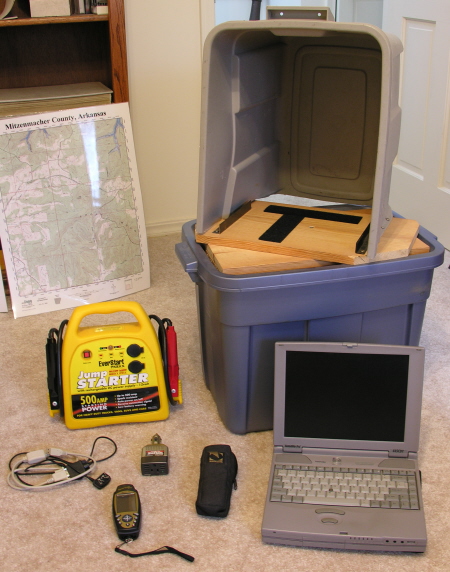
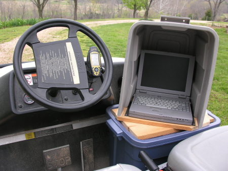
Notice the following features of my “super-duper, multi-purpose, portable cartographic data collection machine” (SDMPPCDCM).
A) High-tech Rubbermaid containers are utilized to house the necessary components, as well as providing sun-shading capabilities for daytime use. These are inexpensive, readily available, and coincidentally, just the right dimensions to fit snugly into our utility vehicle.
B) This application for a laptop computer consumes lots of power. The computer cannot use any power saving modes while mapping, the screen must be set for full power to be visible in the daylight, and the hard disk drive and CDrom are always busy performing mapping chores. Rather than trying to create a properly conditioned power supply from the utility vehicle’s electrical system, which would have been a project unto itself, I opted to power the system with an automotive rechargeable booster pack, available (of course) from our local Wal-Mart. By adding a simple and inexpensive power inverter, this system can be operated at full power for a lot more hours than I care to work in a day.
C) The laptop is affixed to the turntable by a pair of stabilizing rails on the side of the turntable, and secured with industrial Velcro attached to the bottom of the computer. The turntable swivels on a simple pivot, allowing me to easily adjust the viewing angle. The entire package is secured to the vehicle with a heavy duty bungee cord.
D) The GPS unit, which feeds data to the computer via a data cable, is mounted on the dashboard of the vehicle with a quick-release mount built especially for this particular GPS unit. This allows for excellent visibility while driving, and allows me to easily pop off the GPS and use it on foot when necessary.
When mounted in the utility vehicle, the entire contraption appears as below:
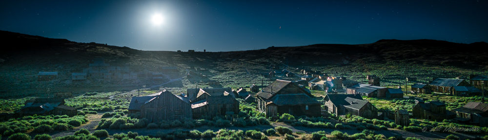
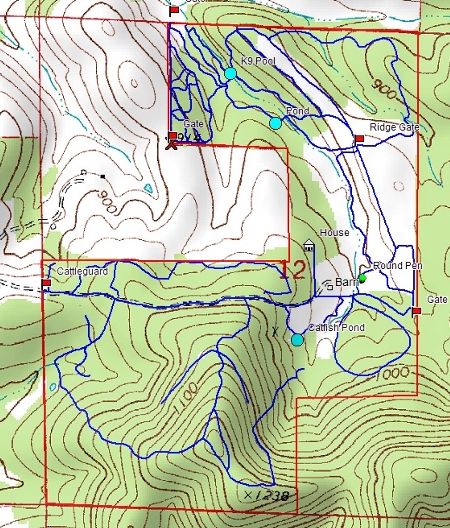
An example of the results obtained with this system can be seen in the following map printout, which is a screen shot from the Delorme mapping software. This particular map layer that is pictured shows the trail network as it exists on the ranch. There are unlimited layers available, and I have used them for many purposes.
You may ask, “Hal, what prompts you to spend so much time rambling on about computerized mapping systems and such?”  Pablo, editor of the Roundrock Journal, a fine and highly popular Missouri blog, recently mused about solitary shag bark hickory and walnut trees on his property. The question arose as to weather solitary trees of this type would produce nuts. I suppose a normal person who is motivated to find an answer to this question would, with a few well-defined queries to Google, come up with an answer in short order. But I am (thankfully) not normal!
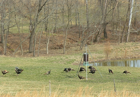
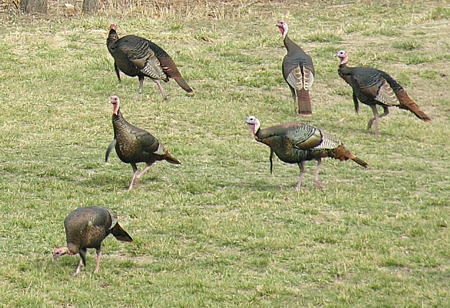
Three years ago, I began a long-term project of mapping the approximately 150 black walnut trees that exist on the ranch. Each year, I use my GPS data to locate each of these trees, and I note their status as being either “nut-bearing” or not, as the case may be. I then use this data to plan my bush-hogging schedule, so that the trees are accessible to my friend Jasper when he comes around in the fall to gather our black walnuts. It is my thought that I can utilize the data that I am collecting to answer the pressing question of solitary nut trees (if I should be fortunate to live long enough to collect a meaningful amount of data). I am also attempting to see if I can find any direct correlation between nut production and weather patterns. This may be grist for a future post (if I can find any results worth posting).